
Points of interest
Points of interest
Let the journey begin!
Number of results: 659
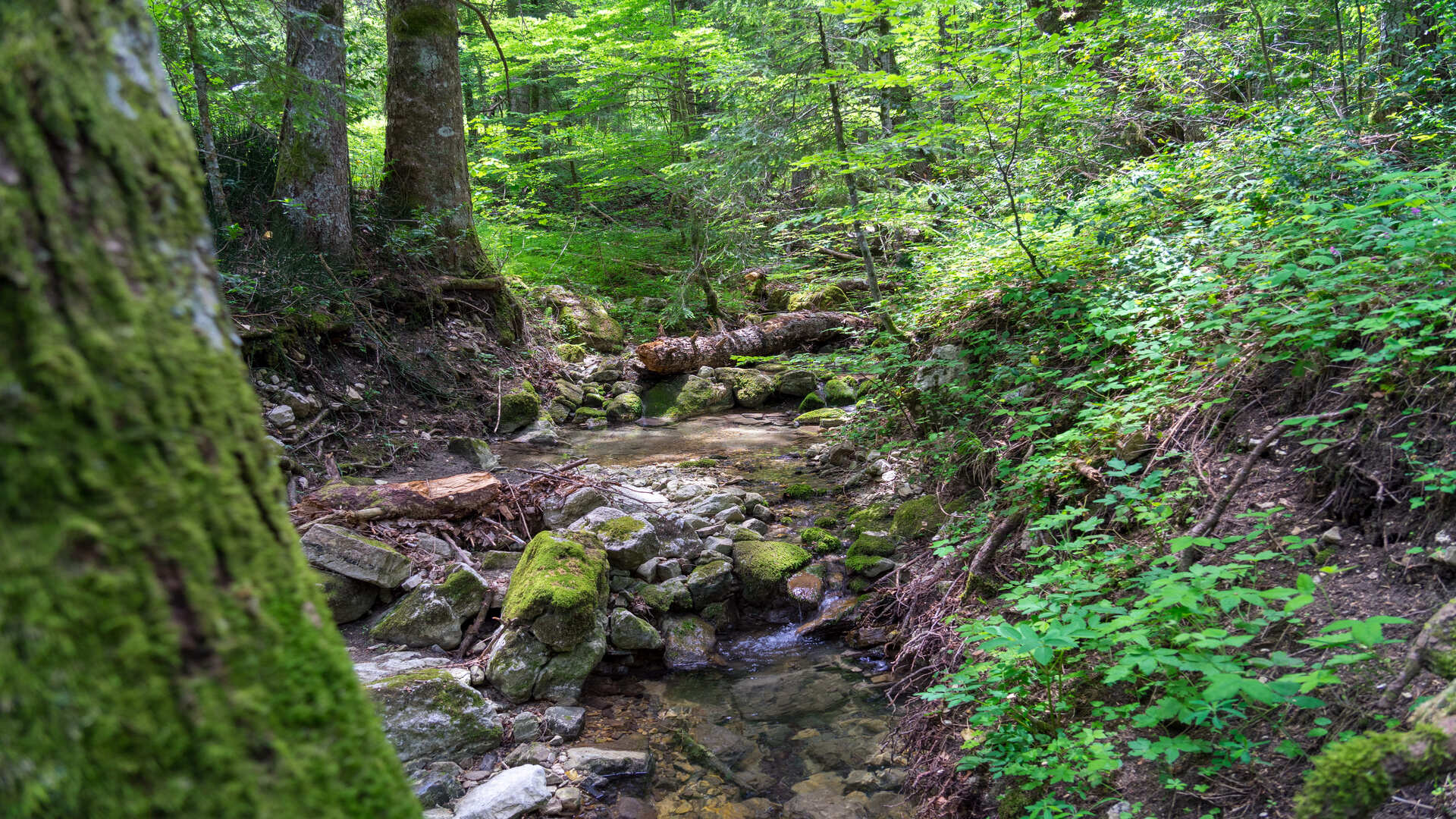

Abetina di Pescopennataro
Molise
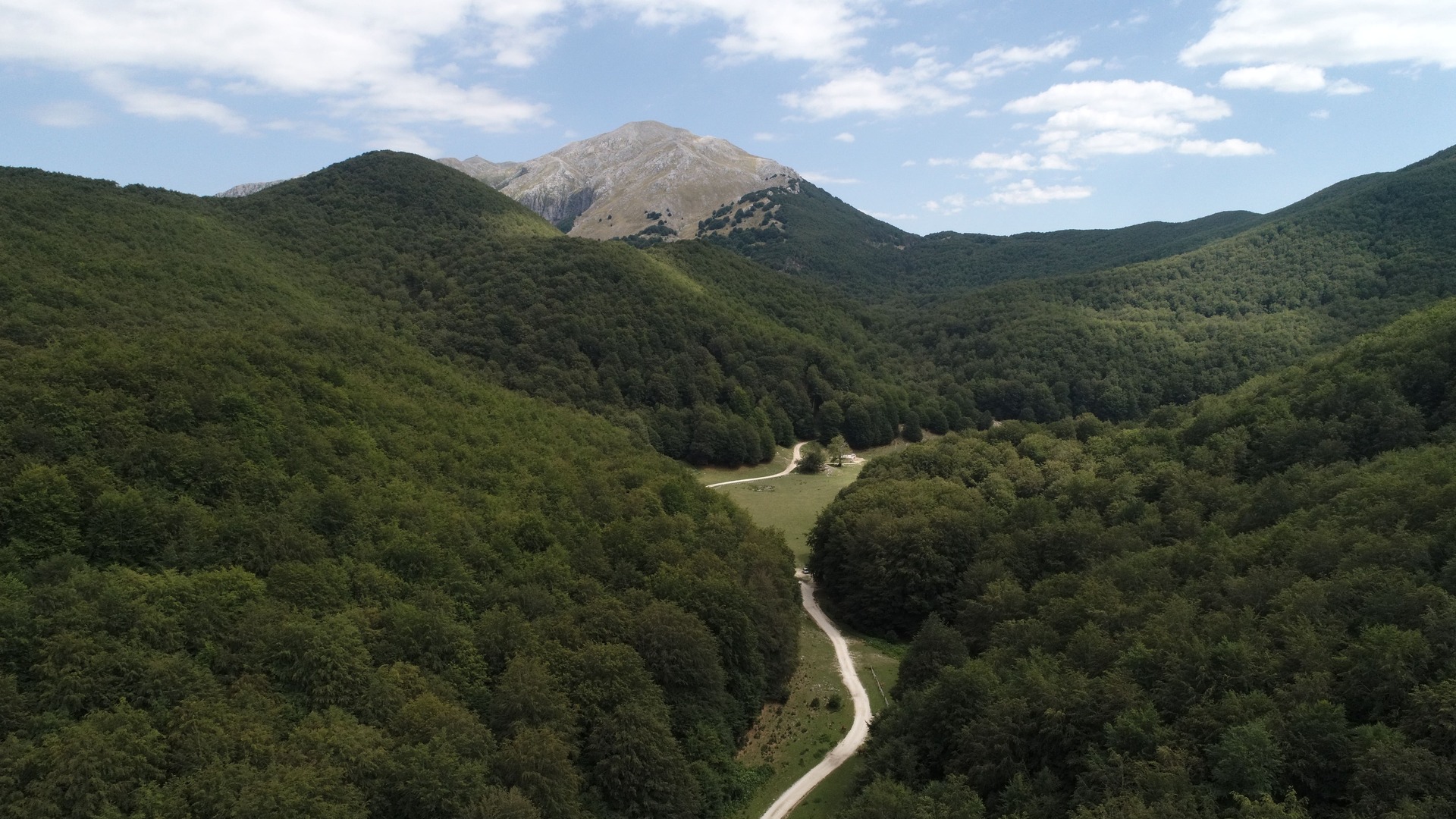
The Abetina di Pescopenntaro is a Site of Community Importance called "Abeti Soprani - Monte Campo - Monte Castelbarone - Sorgente del Verde". The area is included in the municipalities of Pescopennataro and Sant'Angelo del Pesco and has a total surface of 3033 hectares and the surface of the fir-wood in its pure state is about 1000 hectares. The average altitude of the area is between 1250 and 1300 meters.
Protected natural areas
Villages and old cities
Bosco di Monte Vairano
Molise
Monte Vairano extends in the municipalities of Campobasso and Busso, the highest point reaches 998 m.s.l.m., the area is covered by a thick coppice vegetation and some reforested areas. The most present species is the Cerro matricinato (important economic element of the area for its high productivity), the Roverella, the Farnetto, the Orniello, the Carpino nero, the Castagno, the Ginepro; the Quercia spinosa. The wide reforestations are constituted by the Mediterranean Pine and Cypress, there is also the sporadic presence of rare species such as the Silver Fir and the Larch, which contribute to make the landscape more articulated and increase the interest for a forest of great biological value.
Protected natural areas
Villages and old cities
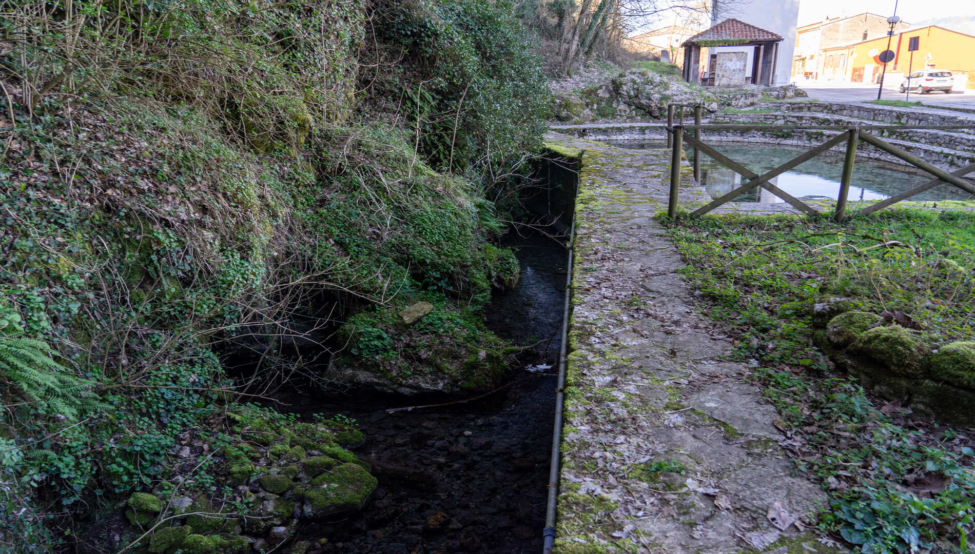
Sorgente Pietre Cadute a Bojano
Molise
The springs of the Pietrecadute group are constituted by the springs of Pietrecadute and Turno, which occupy the entire south-eastern foothills of the town of Bojano, from Pietrecadute to the Palazzo Ducale of Salita Pandone, along Via Biferno and Via Turno. These springs, to the east of Bojano, are the most important for the quantity of water of the internal spring system of Biferno; they flow from numerous springs among the limestones of the mountain and the impermeable marls of tamponade.
Villages and old cities
Lakes and rivers
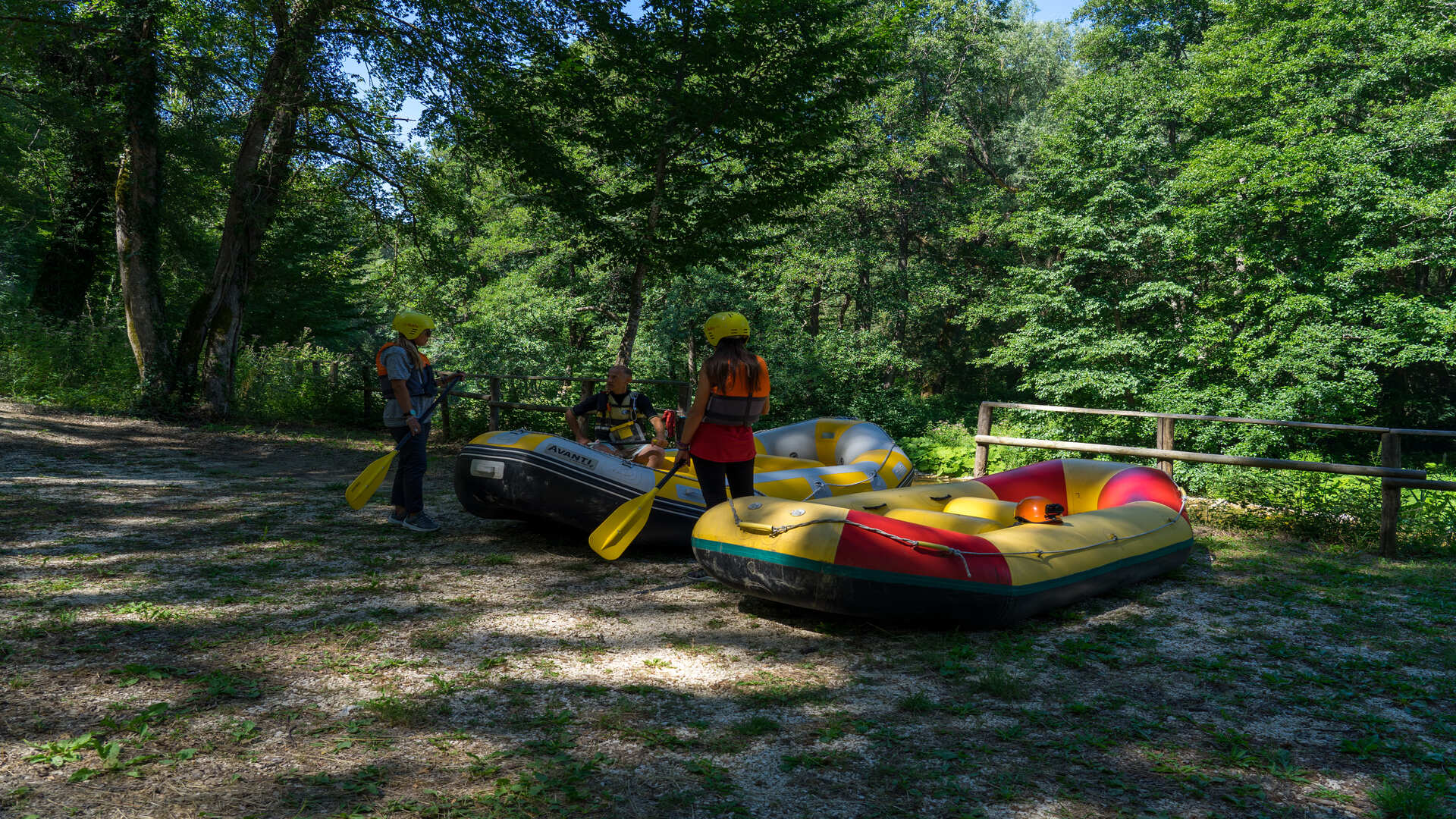
Rafting fiume Sangro a Castel del Giudice
Molise
In Castel del Giudice, on the border between Abruzzo and Molise, the Sangro river crosses an area rich in interest, woods, mountains, paths, waterways, nature reserves and archaeological sites. On the river rafting enthusiasts will find a very suggestive path, the river route is 5 kilometers long and lasts an hour and a half.
Lakes and rivers
Villages and old cities
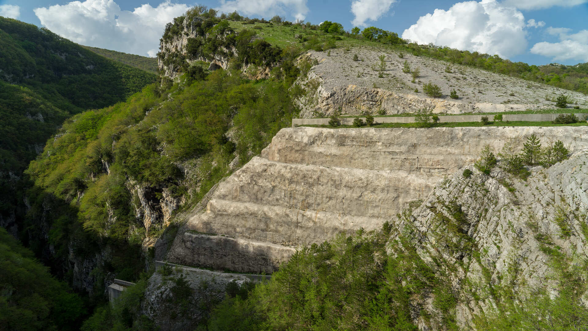
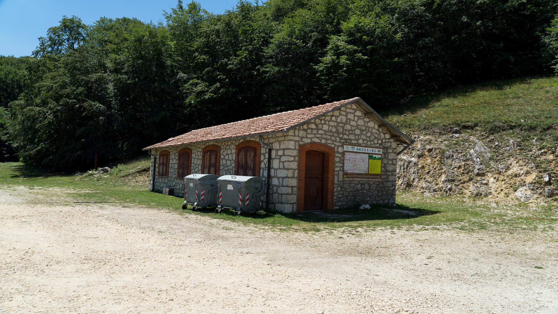
Escursione MTB circuito Cima a Roccamandolfi
Molise
C.I.MA. (Circuito Interregionale del Matese) is a 27 km track born from the collaboration between the Pro-Loco of Longano and Roccamandolfi (Molise area) and Letino and Gallo Matese (Campania area). The path, created and thought for mountain bike lovers, winds through woods and prairies inhabited by herds and flocks grazing.
Villages and old cities
Monte Mauro e la Selva di Montefalcone
Molise
Monte Mauro and Selva di Montefalcone nel Sannio is an important Site of Community Interest (S.I.C.), 500 hectares of forest area consisting mainly of turkey oaks and beech trees. The area lies between the municipalities of Montefalcone nel Sannio and Castelmauro, in the province of Campobasso, on the border between Abruzzo and Molise.
Villages and old cities
Protected natural areas
La Montagnola Molisana
Molise
The "Montagnola Molisana" is a Site of Community Interest that extends for 4000 hectares in the municipalities of Frosolone, Macchiagodena, Carpinone, Sessano del Molise, Civitanova del Sannio, Chiauci, Santa Maria del Molise and Sant'Elena Sannita. The structure of the mountain plateau is characterized by calcareous rocks rich in fossil organisms of the Cretaceous, the altitudes vary from 1200 to 1400 m above sea level.
Protected natural areas
Villages and old cities
Bosco Corundoli a Montecilfone
Molise
The Corundoli Communal Wood of Montecilfone, is a hilly wood, a few kilometers from the sea, and is one of the first woods to be found between the coast and the Frentani Mountains. The Corundoli hill is of particular geological interest for the presence of gypsum outcrops, whose solubility creates suggestive dolines and caves. The forest covers an area of 80 hectares, the prevalent tree species are the Roverella, the Cerro, the Leccio, the Carpino and the Olmo.
Protected natural areas
Villages and old cities
Oasi WWF Guardiaregia Campochiaro
Molise
The Guardiaregia - Campochiaro Regional Nature Reserve is a protected natural area established in 1996 and extended in 2000. It occupies an area of 3135 hectares, thus representing the second largest Oasis in Italy. Management is established by an agreement between WWF Italy and the municipalities of Guardiaregia and Campochiaro.
Protected natural areas
Villages and old cities
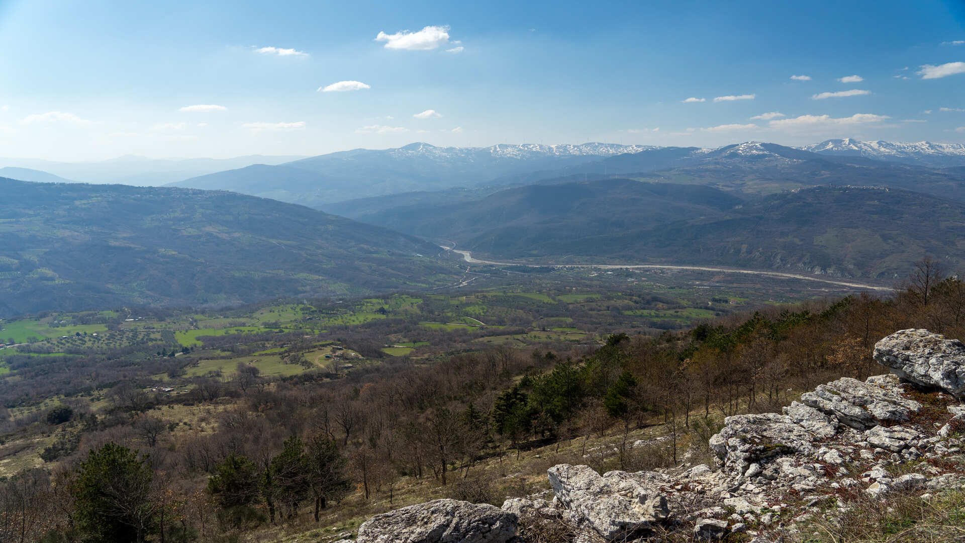
Parco Nazionale del Matese Gallinola-Miletto-Mutria
Molise
he Matese massif marks the border, for more than 50 km, between Molise and Campania. From the peaks of the Matese it is possible to have an extraordinary view of the "two seas" and the main peaks of the center-south.
Protected natural areas
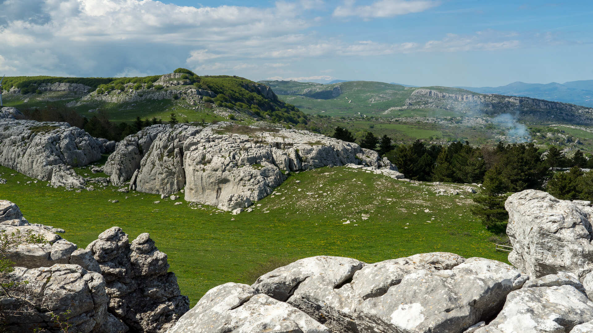
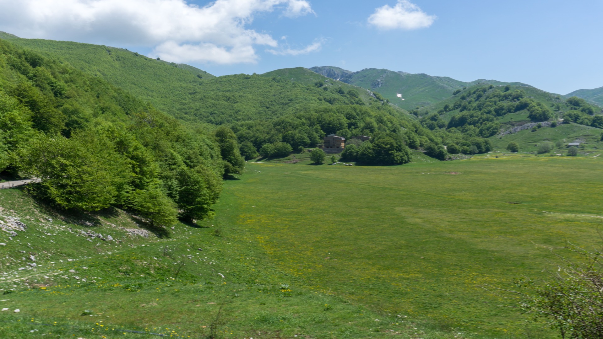
Campitello di Roccamandolfi
Molise
Campitello were plateaus that shepherds and farmers of the high Matese, before the fifties of the last century, managed to snatch from the wild nature and used them to sow wheat, plant potatoes and then use them as fodder and later as summer pastures. Campitello di Roccamandolfi, a large grassy plateau located at an altitude of 1230 meters, about 10 km from the village.
Protected natural areas
Villages and old cities
Parco Regionale dell'Olivo a Venafro
Molise
The Venafro Regional Olive Park, also known as the Oraziano or Campaglione Park, was established by Regional Law in 2008 and in 2018 was included in the prestigious National Register of Historic Rural Landscapes of the Ministry of Agriculture, Food, Forestry and Tourism.
It is the first protected area dedicated to the olive tree, the only one of its kind in the Mediterranean. Venafro oil was already known in ancient times, as Marcus Porcius Cato and Horace spoke of it and considered it to be the finest oil in the ancient world.
Protected natural areas
Villages and old cities
.jpg/212228d4-c3bb-28db-2efe-49824bf5806b)
Sorgenti del Volturno
Molise
The Volturno River is considered the longest river in southern Italy, and is of great importance both for the magnitude of its flow and for the breadth of its catchment area. It rises at Rocchetta a Volturno and flows through the province of Caserta into the Tyrrhenian Sea at Castel Volturno. The springs of Capo Volturno are located at the foot of the eastern slope of Mount Rocchetta, at about 548 m above sea level, forming a small lake. Part of the water coming from the springs is used by Enel to produce electricity, through two hydroelectric power stations located near the village of Rocchetta a Volturno.
Lakes and rivers
Protected natural areas
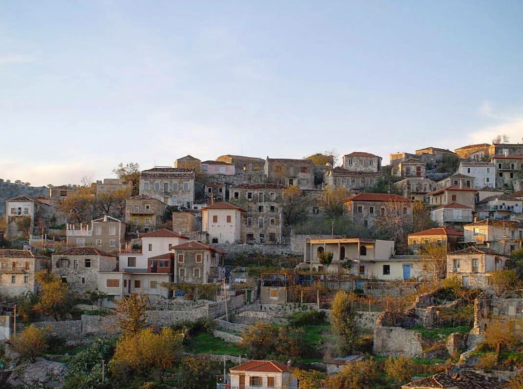

Qeparo Old Village
Albania
Qeparo is a seaside village in the Albanian Riviera, located between Lukova and Himara, and right next to Borsh. The Epirote tribe of the Chaonians in...
History and tradition
Architecture
Villages and old cities
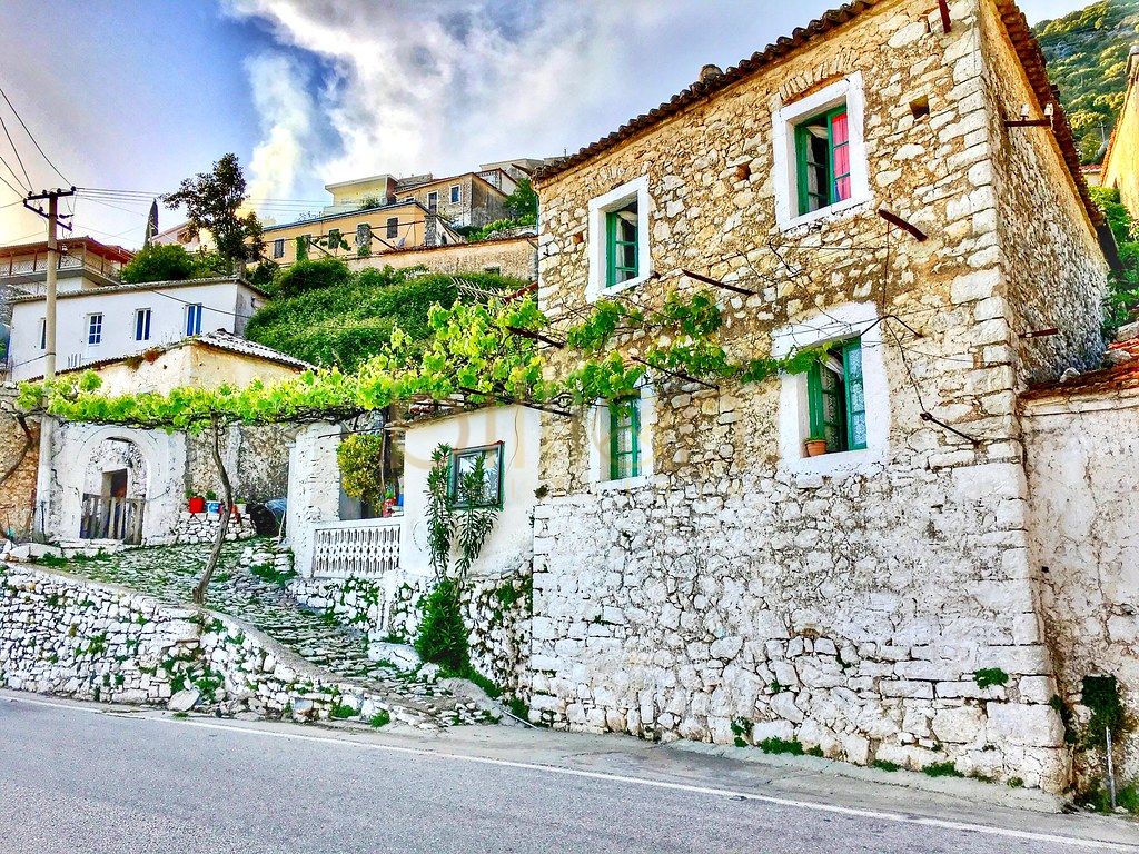
Towers of Vuno
Albania
The stone constructions in Vuno, carried during a period of several centuries, requiring enormous work, great engineering and skilled workmanship, are...
History and tradition
Architecture
Villages and old cities
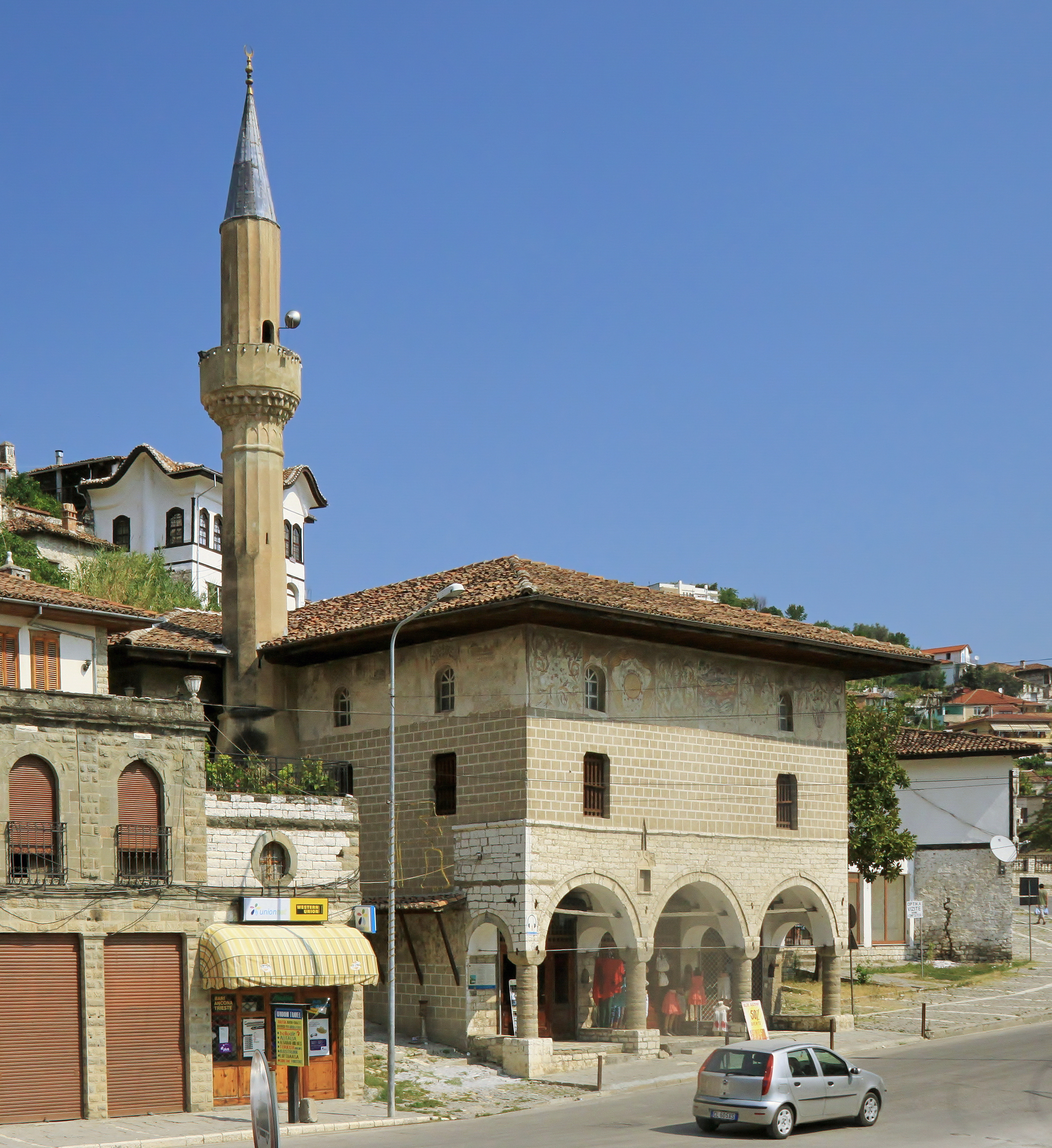
Bachelors Mosque
Albania
History and tradition
Architecture
Religious sites
UNESCO heritage
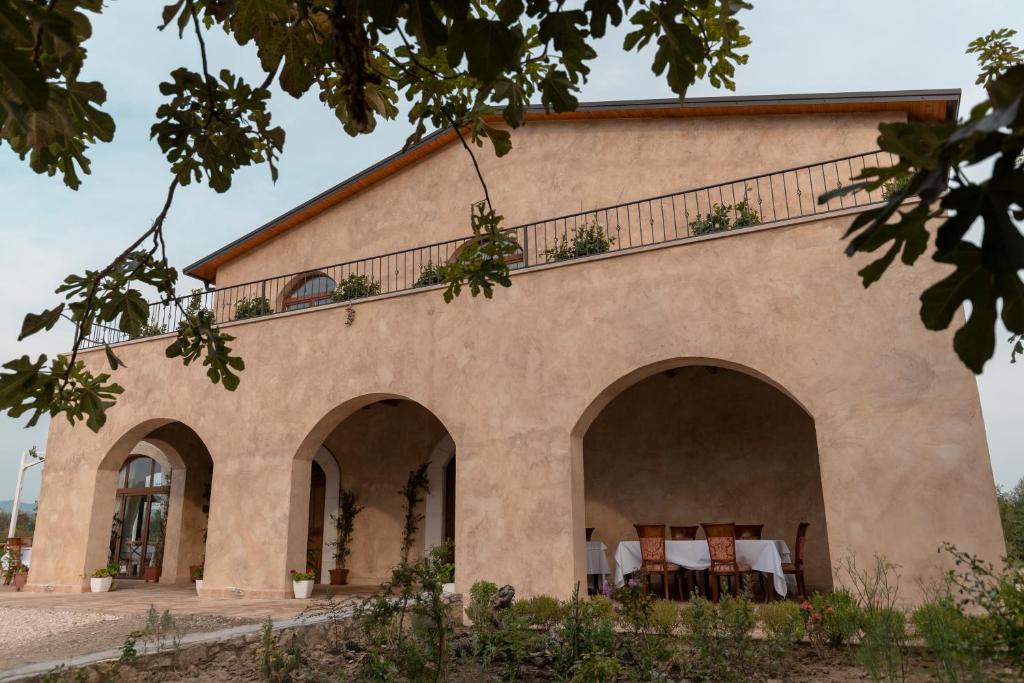
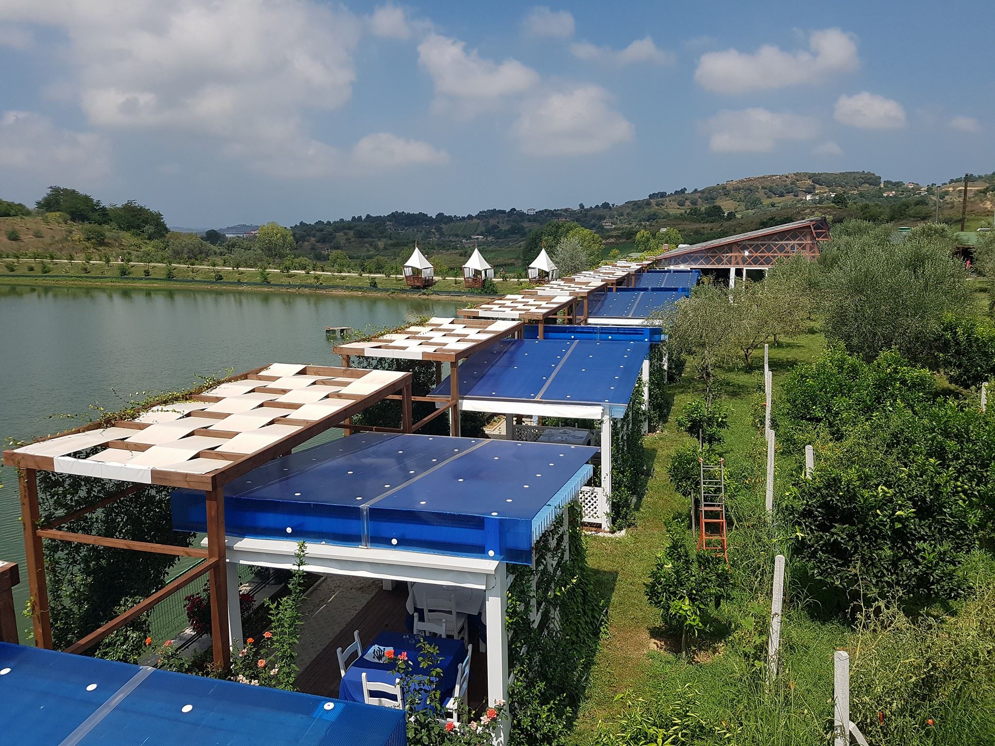
Agroturism Gjepali
Albania
Agroturizem Gjepali is one of 14 certified agrotourism businesses in the country and it is located in the Shijak region of central Albania. The activi...
Architecture
Intangible heritage and craft
Agroturism Huqi
Albania
Agroturizm Huqi is a family-friendly place located in Lalzi Bay (12 km away from it). Started its activity in 2007 Agroturizm Huqi actually comprises ...
Intangible heritage and craft
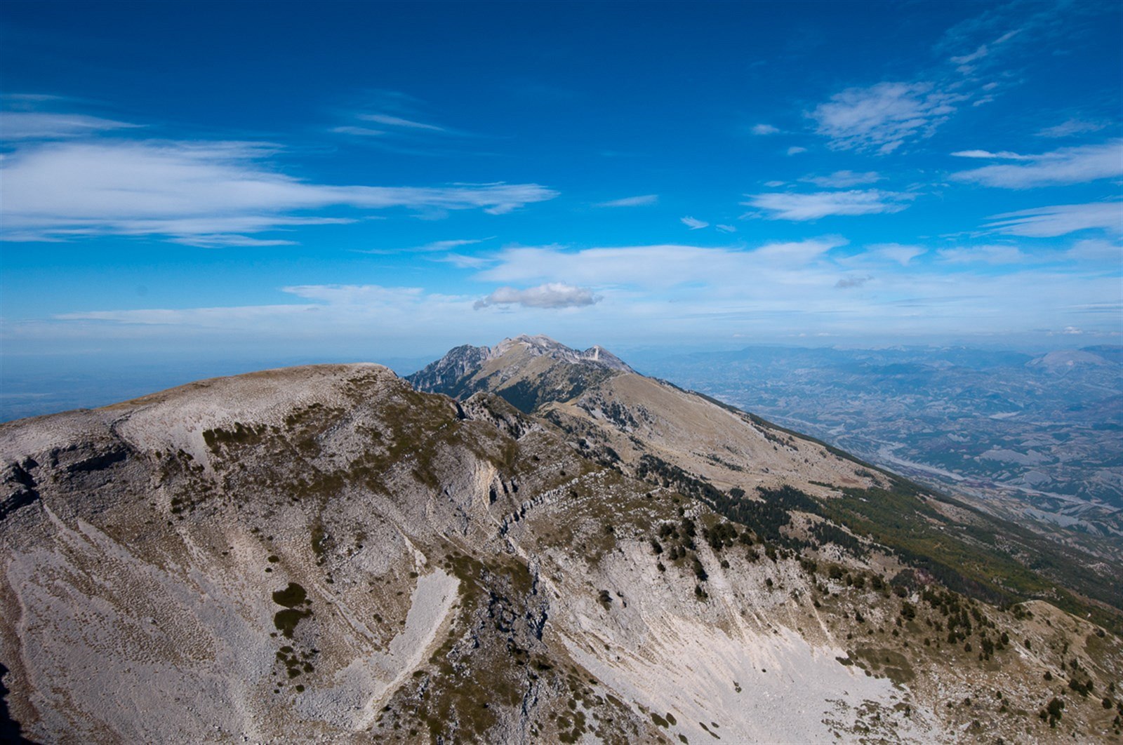
Tomorr National Park
Albania
The Tomorr National Park, founded in 1956, is a National Park, 30-40 km to the east of Berati town. The mountain Tomorr is one of the highest natural ...
Protected natural areas
Religious sites
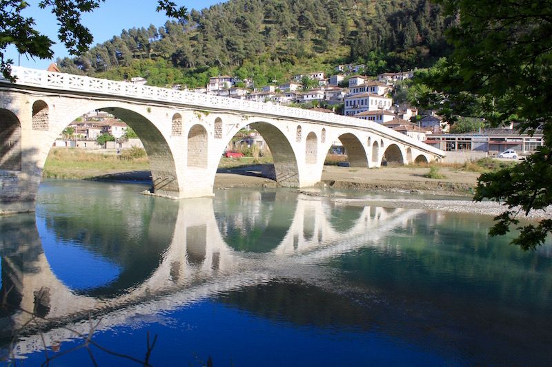
Gorica Bridge
Albania
One of the most beautiful Ottoman bridges in the Balkan region connecting the city with the neighborhood of the same name is Bridge of Gorica. Gorica ...
History and tradition
Architecture
UNESCO heritage