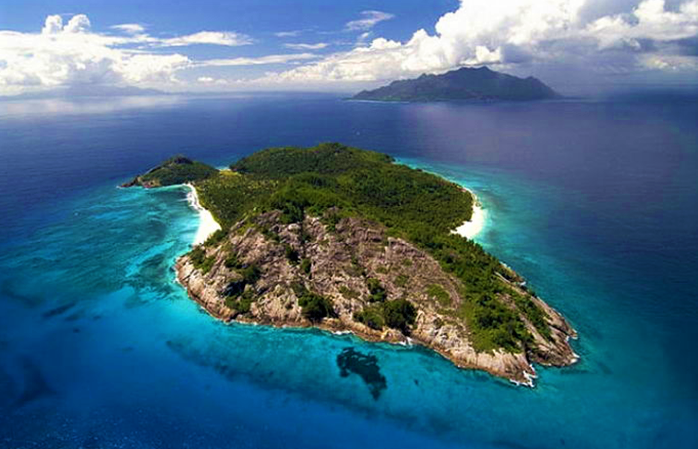
The Island of Sazan is situated at the point where the Adriatic and Ionian seas gently meet in a very important strategic, ecological and social position of the exchange between the eastern and western parts of the Mediterranean region. Opened to the public in 2015, Sazan has quickly become one of the most attractive tourist destinations in the entire country. It is visited daily by small and medium-sized boats that transport tourists for daily beach trips. The site needs 2-3 rocking owls. The bottom-sea structure is gravel.
The Island of Sazan presents a rocky block situated in the north of the cape of Gjuheza in Karaburun and in the west of the bay of Vlora between the strait of Mezocanal. Skylax in the VI century B.C refers to it with the name Sasson, a name used by other authors such as Polybi, Lucani, Plinii and Ptolemeu. After a long period under the role of Venice, it was invaded by the Otoman Empire in the XV century. It is located 15 km in the west of the harbor of Vlora. The 4.8 km wide strait of Mezocanal separated it from the peninsula of Karaburun and the 9 km wide north strait separated it from Triport in the north having a 12-km coastline with monolithic rocks.
It consists of two oval and equal hills with an area of 5.7 km2, the shores of which from 100 m high steep slopes. The water surrounding the Island is 15-20 m deep. The Island itself is 342 m above the sea level with a longitude of 2.8 km and a width of 2 km. The western side of the Island is rocky, while its eastern side consists of the gritty beach of Admiral that extends round the Island with a width of nearly 4-5 m. The bay of St. Kolli together with the port is in the east of it and the lapraku in the south. The ravine of Xhehnemi, with the small and deep bay is in the middle of the Island. The height of the Island falls gradually towards its centre and the valleys of the stream of Xhehnemi and Shenkolli that derive from the pass of Vidhe and flow in opposite direction, divide the island in two parts.
Given its position between the Adriatic and Ionian Sea, the island has always been a strategic point of military defense. On the island there are military structures of different countries (Greek, Italian, German and Albanian) of the 20th century. During the Communist era, the entire island served as one of the largest fortified military bases in the country, and traveling to the island was forbidden to the general public. Until 1992, the only civilian population on the island consisted of military members and their families.
The presence of two churches, archaeological remains, old buildings, drowned ships, land use in the past, etc. constitute other valuable assets for the island. A section of underwater relics such as amphora and other objects found near the island have been recovered by Albanian archeologists and are exhibited at the Historical and Archaeological Museum in Durres.
Can be visited by the sea, by boat departing at the port of Vlora.

